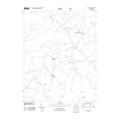
2011 Map of Sturgeon
USGS Topo · Published 2011About this map
Sturgeon Creek and its many tributaries, including Little Sturgeon Creek and Beals Fork, carve a complex drainage pattern across this Jackson County landscape. The area is defined by a network of rural neighborhoods and small settlements rather than a central town, with locales like Moors Neighborhood, Needmore Neighborhood, and Big Spring Neighborhood dotting the hillsides. For genealogists, the map identifies specific family-named landmarks such as the Botner Cemetery and the John Tyler Brewer Cemetery, alongside established community hubs like Vincent Post Office and Greenhill Post Office. Small mountain summits including Hunters Knob and Island Creek Knob rise above the winding valley roads, while the junction of Grassy Creek and Sturgeon Creek highlights the Importance of watercourses in historical settlement placement.
Find a feature on this map
75 named features on this map. Tap any name to fly to it.
Don’t see what you’re looking for? This feature index may not catch every label — zoom into the map to look around manually.
Map Details
Editions of this 2011 Sturgeon Map
This is the sole edition of this map. No revisions or reprints were ever made.
Other maps of this area

1891 · Manchester
USGS Topo · 1:125,000

1892 · Beattyville
USGS Topo · 1:125,000

1952 · Leighton
USGS Topo · 1:24,000

1952 · Beattyville
USGS Topo · 1:24,000

1952 · Heidelberg
USGS Topo · 1:24,000

1953 · Mc Kee
USGS Topo · 1:24,000

1953 · Oneida
USGS Topo · 1:24,000

1953 · Tyner
USGS Topo · 1:24,000

1953 · Booneville
USGS Topo · 1:24,000

1953 · Sturgeon
USGS Topo · 1:24,000