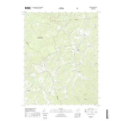
2019 Map of Sturgeon
USGS Topo · Published 2019About this map
Travellers Rest and Sturgeon anchor this 2019 survey of the Eastern Kentucky coalfields, where the drainage of Sturgeon Creek and Little Sturgeon Creek carves a complex network of hollows. The settlement pattern follows these winding watercourses, with small communities like Vincent, Endee, and Mummie situated along the narrow valley floors. Much of the western terrain is protected within the Daniel Boone National Forest, including notable landmarks such as Golden Rock. For local historians and genealogists, the map preserves the locations of several family burial grounds, including the John Tyler Brewer Cem, Botner Cem, and Oliver Cem. The intricate road system, from Logan Cemetery Rd to Veneable-School Rd, reflects the enduring rural character of the Owsley, Jackson, and Lee county borderlands.
Find a feature on this map
87 named features on this map. Tap any name to fly to it.
Don’t see what you’re looking for? This feature index may not catch every label — zoom into the map to look around manually.
Map Details
Editions of this 2019 Sturgeon Map
This is the sole edition of this map. No revisions or reprints were ever made.
Other maps of this area

1891 · Manchester
USGS Topo · 1:125,000

1892 · Beattyville
USGS Topo · 1:125,000

1952 · Leighton
USGS Topo · 1:24,000

1952 · Beattyville
USGS Topo · 1:24,000

1952 · Heidelberg
USGS Topo · 1:24,000

1953 · Mc Kee
USGS Topo · 1:24,000

1953 · Oneida
USGS Topo · 1:24,000

1953 · Tyner
USGS Topo · 1:24,000

1953 · Booneville
USGS Topo · 1:24,000

1953 · Sturgeon
USGS Topo · 1:24,000