
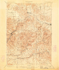
1899 Map of Sturgis
USGS Topo · Published 1899About this map
Sturgis and the surrounding Black Hills define this late 19th-century landscape, where mining and rail infrastructure dominate the terrain. The northern foothills are marked by the Fremont Elkhorn and Missouri Valley R. R. and its Deadwood Branch, threading through the valleys to reach the booming mining center at Deadwood. The map captures the industrial character of the era, from the mills and works around Pluma to the timber resources of the Fort Meade Timber Reservation.
Find a feature on this map
45 named features on this map. Tap any name to fly to it.
Don’t see what you’re looking for? This feature index may not catch every label — zoom into the map to look around manually.
Map Details
Editions of this 1899 Sturgis Map
2 editions found
Other maps of this area

1893 · Rapid
USGS Topo · 1:125,000

1894 · Deadwood
USGS Topo · 1:125,000

1898 · Rapid
USGS Topo · 1:125,000

1900 · Spearfish
USGS Topo · 1:62,500

1901 · Deadwood
USGS Topo · 1:125,000

1903 · Rapid
USGS Topo · 1:125,000

1905 · Saint Onge
USGS Topo · 1:62,500

1906 · Vale
USGS Topo · 1:62,500

1907 · Belle Fourche
USGS Topo · 1:125,000

1907 · Redwater
USGS Topo · 1:62,500