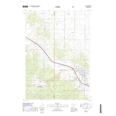
2017 Map of Sturgis
USGS Topo · Published 2017About this map
Black Hills National Forest land meets the urban edge of Sturgis in this detailed layout, showing the transition from mountain terrain to the valley floor. The map highlights the town's grid from Main St to Lazelle St, while the surrounding geography is defined by prominent peaks like Oyster Mtn and Granite Peak. Historical interest is anchored by the Crook City Cem and Saint Aloysius Cem, marking long-standing community foundations.
Find a feature on this map
107 named features on this map. Tap any name to fly to it.
Don’t see what you’re looking for? This feature index may not catch every label — zoom into the map to look around manually.
Map Details
Editions of this 2017 Sturgis Map
This is the sole edition of this map. No revisions or reprints were ever made.
Other maps of this area

1893 · Rapid
USGS Topo · 1:125,000

1894 · Deadwood
USGS Topo · 1:125,000

1898 · Rapid
USGS Topo · 1:125,000

1899 · Sturgis
USGS Topo · 1:62,500

1901 · Deadwood
USGS Topo · 1:125,000

1903 · Rapid
USGS Topo · 1:125,000

1905 · Saint Onge
USGS Topo · 1:62,500

1906 · Vale
USGS Topo · 1:62,500

1907 · Belle Fourche
USGS Topo · 1:125,000

1913 · Newell
USGS Topo · 1:125,000