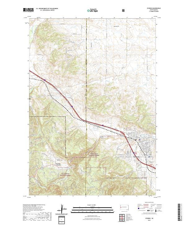
2021 Map of Sturgis
USGS Topo · Published 2021About this map
The city of Sturgis serves as the focal point of this survey, situated at the edge of the Black Hills National Forest. The map documents a complex landscape where the urban grid meets the rising elevations of Sly Hill and the winding course of Bear Butte Cr. Local history is anchored by the Meade County Courthouse and the nearby Saint Aloysius Cem. To the west, the terrain transitions into the steep relief of Boulder Canyon and Oyster Mtn. Beyond the city center, the survey tracks rural developments like Boulder Park and the outlying Crook City Cem. The presence of named landmarks such as Granite Peak and the high Snake Bench illustrates the varied topography that has long shaped the settlement patterns and roadway corridors in this portion of Meade County.
Find a feature on this map
103 named features on this map. Tap any name to fly to it.
Don’t see what you’re looking for? This feature index may not catch every label — zoom into the map to look around manually.
Map Details
Editions of this 2021 Sturgis Map
This is the sole edition of this map. No revisions or reprints were ever made.
Other maps of this area

1893 · Rapid
USGS Topo · 1:125,000

1894 · Deadwood
USGS Topo · 1:125,000

1898 · Rapid
USGS Topo · 1:125,000

1899 · Sturgis
USGS Topo · 1:62,500

1901 · Deadwood
USGS Topo · 1:125,000

1903 · Rapid
USGS Topo · 1:125,000

1905 · Saint Onge
USGS Topo · 1:62,500

1906 · Vale
USGS Topo · 1:62,500

1907 · Belle Fourche
USGS Topo · 1:125,000

1913 · Newell
USGS Topo · 1:125,000