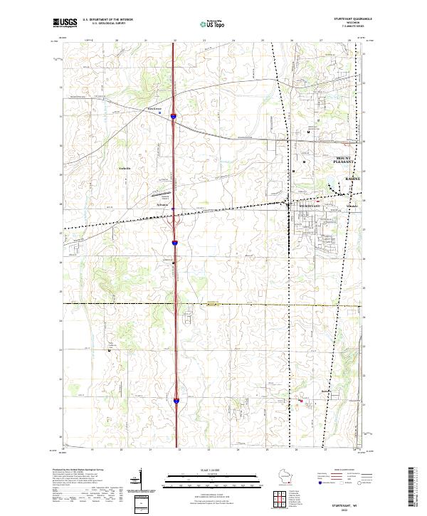
2022 Map of Sturtevant
USGS Topo · Published 2022About this map
Sturtevant and the surrounding agricultural corridor of Racine County are defined by a complex drainage network including the E Br Root River Canal, Hoods Cr, and Pike River. The landscape reflects a transition from rural crossroads like Ives Grove and Yorkville to the industrial and suburban edges of Mount Pleasant and Waxdale. Local aviation history is anchored by the Sylvania Airport near the settlement of Sylvania. For those tracing family history, several prominent burial grounds are situated throughout the area, including West Lawn Memorial Cem, Sylvania Cem, and Paris Lutheran Cem. The transportation infrastructure is well-established, with roads such as Plank Rd and Durand Ave connecting these diverse communities, while the border between Racine Co and Kenosha Co cuts across the southern portion of the sheet near Somers.
Find a feature on this map
55 named features on this map. Tap any name to fly to it.
Don’t see what you’re looking for? This feature index may not catch every label — zoom into the map to look around manually.
Map Details
Editions of this 2022 Sturtevant Map
This is the sole edition of this map. No revisions or reprints were ever made.
Other maps of this area

1891 · Bayview
USGS Topo · 1:62,500

1891 · Muskego
USGS Topo · 1:62,500

1892 · Racine
USGS Topo · 1:62,500

1893 · Silver Lake
USGS Topo · 1:62,500

1901 · Bayview
USGS Topo · 1:62,500

1901 · Muskego
USGS Topo · 1:62,500

1905 · Racine
USGS Topo · 1:62,500

1906 · Silver Lake
USGS Topo · 1:62,500

1954 · Rockford
USGS Topo · 1:250,000

1955 · Rockford
USGS Topo · 1:250,000