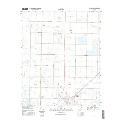
2017 Map of Stuttgart North
USGS Topo · Published 2017About this map
Stuttgart anchors the southern portion of this region, serving as a hub for the agricultural heartland of the Grand Prairie. This survey captures the town's northward expansion towards North Stuttgart and the Stuttgart Municipal Airport, while the surrounding landscape is partitioned into a geometric grid of section lines and irrigation-fed rice fields. The eastern half is defined by significant water management infrastructure, including Wolf Reservoir, Aker Reservoir, and Lost Island Reservoir, which are vital to the local economy. Several family and community landmarks are preserved on the sheet, such as Fairmount Cem near the settlement of Fairmount and the Lutheran Cem further south. The natural drainage of Little LaGrue Bayou and Lost Island Bayou contrasts with the straight-line roads like Prislousky Rd and Old England Hwy, illustrating the long-standing efforts to tame this fertile Arkansas delta land.
Find a feature on this map
108 named features on this map. Tap any name to fly to it.
Don’t see what you’re looking for? This feature index may not catch every label — zoom into the map to look around manually.
Map Details
Editions of this 2017 Stuttgart North Map
This is the sole edition of this map. No revisions or reprints were ever made.
Other maps of this area

1935 · Clarendon
USGS Topo · 1:62,500

1937 · Stuttgart
USGS Topo · 1:62,500

1939 · Stuttgart
USGS Topo · 1:62,500

1941 · De Witt
USGS Topo · 1:62,500

1941 · Goldman
USGS Topo · 1:62,500

1941 · Clarendon
USGS Topo · 1:62,500

1948 · Helena
USGS Topo · 1:250,000

1950 · Helena
USGS Topo · 1:250,000

1954 · De Witt
USGS Topo · 1:62,500

1955 · Helena
USGS Topo · 1:250,000