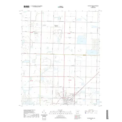
2020 Map of Stuttgart North
USGS Topo · Published 2020About this map
Grand Prairie rice country defines the landscape north of Stuttgart, where the rectangular grid of the Public Land Survey System creates a patchwork of fields and reservoirs. This agricultural intensity is supported by an intricate water management network including Wolf Reservoir, Lost Island Reservoir, and Daugherty Reservoir, which divert water from natural drainage such as Little LaGrue Bayou. The map illustrates the expansion of Stuttgart toward the north, anchored by the Arkansas County Circuit Court and the residential streets of North Stuttgart. Outside the city limits, smaller settlements like Fairmount and Kay persist alongside the Stuttgart Municipal Airport Carl Humphrey Field. For genealogists, the map is particularly useful for locating rural burial sites such as Tate Cem, Lutheran Cem, and Fairmont Cem which are scattered across the township lines.
Find a feature on this map
65 named features on this map. Tap any name to fly to it.
Don’t see what you’re looking for? This feature index may not catch every label — zoom into the map to look around manually.
Map Details
Editions of this 2020 Stuttgart North Map
This is the sole edition of this map. No revisions or reprints were ever made.
Other maps of this area

1935 · Clarendon
USGS Topo · 1:62,500

1937 · Stuttgart
USGS Topo · 1:62,500

1939 · Stuttgart
USGS Topo · 1:62,500

1941 · De Witt
USGS Topo · 1:62,500

1941 · Goldman
USGS Topo · 1:62,500

1941 · Clarendon
USGS Topo · 1:62,500

1948 · Helena
USGS Topo · 1:250,000

1950 · Helena
USGS Topo · 1:250,000

1954 · De Witt
USGS Topo · 1:62,500

1955 · Helena
USGS Topo · 1:250,000