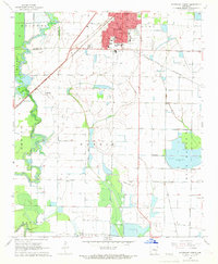
1968 Map of Stuttgart South
USGS Topo · Published 1969About this map
Stuttgart anchors the northern edge of this Arkansas landscape, where the St Louis Southwestern railroad cuts a diagonal line through the surrounding agricultural plains. The 1968 topography reflects a highly engineered water management system, critical for the region's rice and soybean cultivation, featuring extensive Reservoirs, the Stuttgart King Bayou Ditch, and the winding course of Bayou Meto to the west. Local history is deeply etched into the rural sections through landmarks like Holy Rosary Cem, Lone Tree Cemetery, and St Johns Sch. In the southern half, smaller community hubs like Goldman and Townhall appear alongside named land tracts such as Morris and Garland. The map documents a moment of industrial transition, showing a dense network of flumes and irrigation wells alongside municipal features like Cain Park and various radio towers.
Find a feature on this map
32 named features on this map. Tap any name to fly to it.
Don’t see what you’re looking for? This feature index may not catch every label — zoom into the map to look around manually.
Map Details
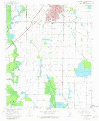
Editions of this 1968 Stuttgart South Map
2 editions found
Other maps of this area

1935 · Clarendon
USGS Topo · 1:62,500

1937 · Stuttgart
USGS Topo · 1:62,500

1939 · Stuttgart
USGS Topo · 1:62,500

1941 · De Witt
USGS Topo · 1:62,500

1941 · Goldman
USGS Topo · 1:62,500

1941 · Clarendon
USGS Topo · 1:62,500

1948 · Helena
USGS Topo · 1:250,000

1950 · Helena
USGS Topo · 1:250,000

1954 · De Witt
USGS Topo · 1:62,500

1955 · Helena
USGS Topo · 1:250,000