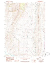
1985 Map of Sublet
USGS Topo · Published 1985About this map
Commissary Ridge and Oyster Ridge frame the high-elevation drainages of Lincoln County in this 1985 survey. The landscape is defined by the central Pomeroy Basin, where a complex network of seasonal and perennial streams like Beachler Creek and Docking Corral Creek converge. The settlement of Sublet sits along the eastern ridge, a focal point for researchers interested in the legacy of high-desert ranching and resource management in the western portion of the state.
Find a feature on this map
23 named features on this map. Tap any name to fly to it.
Don’t see what you’re looking for? This feature index may not catch every label — zoom into the map to look around manually.
Map Details
Editions of this 1985 Sublet Map
This is the sole edition of this map. No revisions or reprints were ever made.
Other maps of this area

1936 · Cokeville
USGS Topo · 1:96,000

1942 · Cokeville
USGS Topo · 1:125,000

1945 · Fort Hill
USGS Topo · 1:62,500

1947 · Fort Hill
USGS Topo · 1:62,500

1954 · Ogden
USGS Topo · 1:250,000

1954 · Kemmerer
USGS Topo · 1:62,500

1955 · Preston
USGS Topo · 1:250,000

1958 · Ogden
USGS Topo · 1:250,000

1958 · Preston
USGS Topo · 1:250,000

1960 · Ogden
USGS Topo · 1:250,000