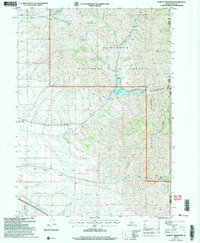
2001 Map of Sublett Reservoir
USGS Topo · Published 2006About this map
The California Historic National Trail traverses this high-elevation terrain in Cassia County, following the path of the original Sublett Cut-Off. This route was a critical segment for westward migrants, and its preservation here within the Sawtooth National Forest allows for the tracing of 19th-century overland travel. The landscape is defined by the steep rises of the Sublett Range, where water sources like South Fork Fall Creek Spring and Shirley Creek feed into the high basin.
Find a feature on this map
24 named features on this map. Tap any name to fly to it.
Don’t see what you’re looking for? This feature index may not catch every label — zoom into the map to look around manually.
Map Details
Editions of this 2001 Sublett Reservoir Map
This is the sole edition of this map. No revisions or reprints were ever made.
Other maps of this area

1954 · Pocatello
USGS Topo · 1:250,000

1958 · Pocatello
USGS Topo · 1:250,000

1958 · Sublett
USGS Topo · 1:62,500

1959 · Strevell
USGS Topo · 1:62,500

1973 · Juniper
USGS Topo · 1:24,000

1973 · Hartley Peak
USGS Topo · 1:24,000

1973 · Sublett Troughs
USGS Topo · 1:24,000
1984 · Malad City
USGS Topo · 1:100,000
1985 · North Heglar Canyon
USGS Topo · 1:24,000
1985 · Sandrock Canyon
USGS Topo · 1:24,000