
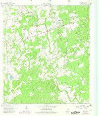
1962 Map of Sublime
USGS Topo · Published 1966About this map
Navidad River and its meandering tributaries, including Sandies Creek and Brushy Creek, define the topography of this central Lavaca County landscape. The settlement of Sublime appears along the Old Railroad Grade, with a distinct grid of streets including Texana St and Oakland St. Smaller rural clusters such as Vsetin and Vienna are visible, each anchored by community institutions like Immanuel Ch and Vienna Ch. Genealogists and local researchers will find several family-linked burial grounds, most notably the Pagel Settlement Cem, Miller Cem, and Willow Creek Cem. The landscape transition from agricultural fields to wooded creek bottoms is interspersed with evidence of local industry, including a Gravel Pit near Vsetin and a Claypit further south, illustrating the resource-driven economy of the early 1960s.
Find a feature on this map
21 named features on this map. Tap any name to fly to it.
Don’t see what you’re looking for? This feature index may not catch every label — zoom into the map to look around manually.
Map Details
Editions of this 1962 Sublime Map
2 editions found
Other maps of this area

1919 · Schulenburg
USGS Topo · 1:62,500

1953 · Seguin
USGS Topo · 1:250,000

1956 · Glidden
USGS Topo · 1:62,500

1958 · Seguin
USGS Topo · 1:250,000

1962 · Hallettsville SE
USGS Topo · 1:24,000

1962 · Hallettsville
USGS Topo · 1:24,000

1964 · Speaks
USGS Topo · 1:24,000

1964 · Ezzell
USGS Topo · 1:24,000

1965 · Oakland
USGS Topo · 1:24,000

1965 · Sawmill Branch
USGS Topo · 1:24,000