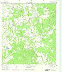
1962 Map of Sublime
USGS Topo · Published 1983About this map
Sublime and the surrounding Lavaca County countryside appear here as a landscape shaped by the Navidad River and its intricate drainage network. Settled around the Old Railroad Grade, this area retains the markers of early Texas settlement, including the distinct clusters at Vienna and Vsetin. For genealogists, the map is particularly detailed, recording family and community landmarks such as Pagel Settlement Cem, Fuller Cem, and the Smoot-Hamilton Cem.
Find a feature on this map
25 named features on this map. Tap any name to fly to it.
Don’t see what you’re looking for? This feature index may not catch every label — zoom into the map to look around manually.
Map Details
Editions of this 1962 Sublime Map
2 editions found
Other maps of this area

1919 · Schulenburg
USGS Topo · 1:62,500

1953 · Seguin
USGS Topo · 1:250,000

1956 · Glidden
USGS Topo · 1:62,500

1958 · Seguin
USGS Topo · 1:250,000

1962 · Sublime
USGS Topo · 1:24,000

1962 · Hallettsville SE
USGS Topo · 1:24,000

1962 · Hallettsville
USGS Topo · 1:24,000

1964 · Speaks
USGS Topo · 1:24,000

1964 · Ezzell
USGS Topo · 1:24,000

1965 · Oakland
USGS Topo · 1:24,000