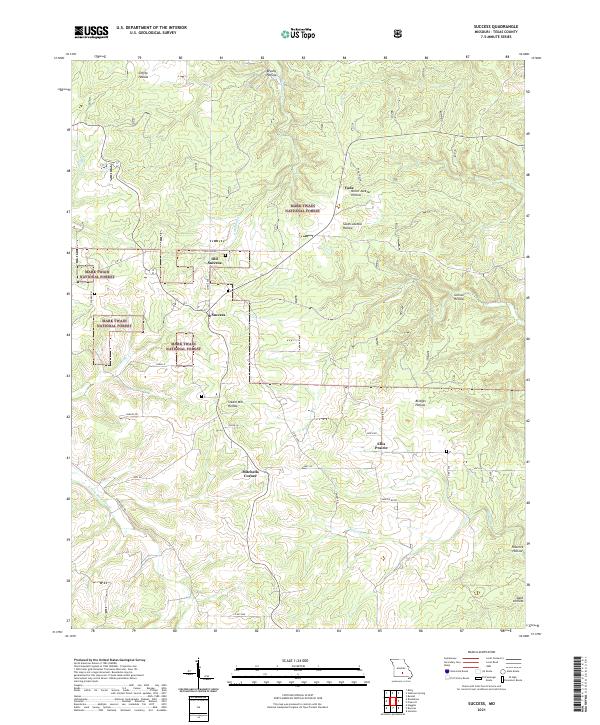
2021 Map of Success
USGS Topo · Published 2021About this map
Success and Old Success anchor this section of Texas County, documenting the distinct settlement patterns of the Ozark Plateau. Much of the northern and western terrain is characterized by the deeply incised drainages of the Mark Twain National Forest, where steep-walled features like Steam Mill Hollow and North Jacktar Hollow cut through the landscape. The nomenclature of the area reflects both its topographical character and industrial history, seen in the Vada Tower landmark near the small community of Vada.
Find a feature on this map
42 named features on this map. Tap any name to fly to it.
Don’t see what you’re looking for? This feature index may not catch every label — zoom into the map to look around manually.
Map Details
Editions of this 2021 Success Map
This is the sole edition of this map. No revisions or reprints were ever made.
Other maps of this area

1937 · Edgar Springs
USGS Topo · 1:48,000

1941 · Big Piney
USGS Topo · 1:62,500

1941 · Bado
USGS Topo · 1:62,500

1943 · Big Piney
USGS Topo · 1:62,500

1943 · Bado
USGS Topo · 1:62,500

1945 · Edgar Springs
USGS Topo · 1:62,500

1949 · Rolla
USGS Topo · 1:250,000

1951 · Prescott
USGS Topo · 1:24,000

1951 · Houston
USGS Topo · 1:24,000

1951 · Raymondville
USGS Topo · 1:62,500