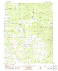
1987 Map of Success
USGS Topo · Published 1987About this map
Roubidoux Creek and its East Fork carve through this section of the Ozarks within the Mark Twain National Forest. The landscape is defined by a dense network of hollows, including Steam Mill Hollow, Gillian Hollow, and Hot Hollow, which drain toward the larger watercourses. Small settlements and rural crossroads like Success and Old Success serve as focal points for the local community, while more remote locales like Ellis Prairie and Bridges reflect the dispersed settlement pattern of Texas County during the late 1980s.
Find a feature on this map
27 named features on this map. Tap any name to fly to it.
Don’t see what you’re looking for? This feature index may not catch every label — zoom into the map to look around manually.
Map Details
Editions of this 1987 Success Map
This is the sole edition of this map. No revisions or reprints were ever made.
Other maps of this area

1937 · Edgar Springs
USGS Topo · 1:48,000

1941 · Big Piney
USGS Topo · 1:62,500

1941 · Bado
USGS Topo · 1:62,500

1943 · Big Piney
USGS Topo · 1:62,500

1943 · Bado
USGS Topo · 1:62,500

1945 · Edgar Springs
USGS Topo · 1:62,500

1949 · Rolla
USGS Topo · 1:250,000

1951 · Prescott
USGS Topo · 1:24,000

1951 · Houston
USGS Topo · 1:24,000

1951 · Raymondville
USGS Topo · 1:62,500