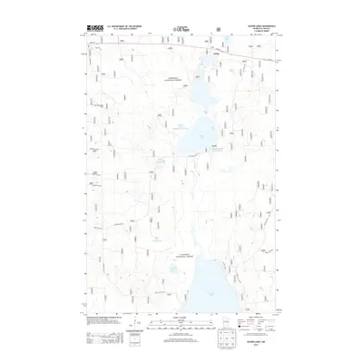
2013 Map of Sucker Lakes
USGS Topo · Published 2013About this map
Chippewa National Forest surrounds the small settlement of Schley, which sits along the northern corridor of Us HWY 2. This landscape is defined by its extensive water management and wildlife conservation features, notably the series of large reservoirs including the Middle Sucker Wildlife Impoundment, Ketchum Wildlife Impoundment, and Sucker Bay Impoundment. These man-made features interact with the natural flow of Sucker Cr as it drains toward the northern reaches of Leech Lake, which dominates the southern boundary of the map.
Find a feature on this map
23 named features on this map. Tap any name to fly to it.
Don’t see what you’re looking for? This feature index may not catch every label — zoom into the map to look around manually.
Map Details
Editions of this 2013 Sucker Lakes Map
This is the sole edition of this map. No revisions or reprints were ever made.
Other maps of this area

1954 · Bemidji
USGS Topo · 1:250,000

1957 · Bemidji
USGS Topo · 1:250,000

1958 · Bemidji
USGS Topo · 1:250,000
1971 · Raven Lake
USGS Topo · 1:24,000
1971 · Sucker Lakes
USGS Topo · 1:24,000
1971 · Pennington
USGS Topo · 1:24,000
1971 · Portage Lake
USGS Topo · 1:24,000
1971 · Ottertail Point
USGS Topo · 1:24,000
1971 · Sugar Point
USGS Topo · 1:24,000
1972 · Steamboat Bay
USGS Topo · 1:24,000