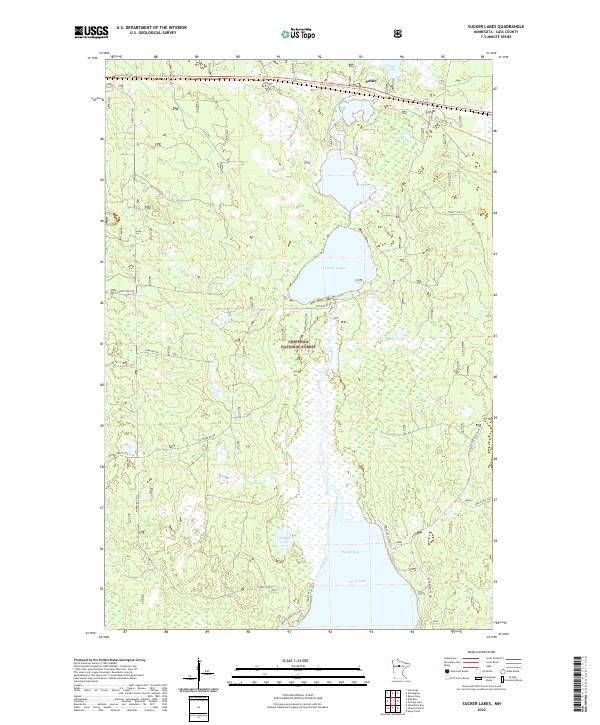
2022 Map of Sucker Lakes
USGS Topo · Published 2022About this map
Chippewa National Forest encompasses this wetland-rich portion of Cass County, where the northern reaches of Leech Lake dominate the lower half of the landscape. The settlement of Schley sits in the northern corner along the Soo Line Atv Trl, following a corridor that traces the historic rail path through the timber. Central to the area are the Sucker Lakes, which feed into Sucker Bay via Sucker Creek. The topography is defined by complex hydrology, including isolated water bodies like Life Raft Lake, Foot Lake, and Grass Lake. A network of forest routes, including Forest Rte 2133 and Forest Rte 2930, provides access through the heavily wooded terrain, while Cuba Hill Rd offers a distinct landmark for those navigating the western reaches of the forest.
Find a feature on this map
25 named features on this map. Tap any name to fly to it.
Don’t see what you’re looking for? This feature index may not catch every label — zoom into the map to look around manually.
Map Details
Editions of this 2022 Sucker Lakes Map
This is the sole edition of this map. No revisions or reprints were ever made.
Other maps of this area

1954 · Bemidji
USGS Topo · 1:250,000

1957 · Bemidji
USGS Topo · 1:250,000

1958 · Bemidji
USGS Topo · 1:250,000

1971 · Raven Lake
USGS Topo · 1:24,000

1971 · Sucker Lakes
USGS Topo · 1:24,000

1971 · Pennington
USGS Topo · 1:24,000

1971 · Portage Lake
USGS Topo · 1:24,000
1971 · Ottertail Point
USGS Topo · 1:24,000
1971 · Sugar Point
USGS Topo · 1:24,000

1972 · Steamboat Bay
USGS Topo · 1:24,000