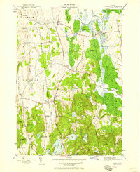
1946 Map of Sudbury
USGS Topo · Published 1958About this map
Hyde Manor and the surrounding valley of the Lemon Fair River anchor this mid-century survey of the Vermont landscape. The map captures a transition between the agricultural lowlands and the pond-dotted highlands of the south, where Lake Hortonia and Burr Pond are situated. A dense network of rural schoolhouses, including the Seth Warner Sch, Hill Sch, and Felton Sch, reflects a distributed township structure before school consolidation changed the character of these rural roads.
Find a feature on this map
54 named features on this map. Tap any name to fly to it.
Don’t see what you’re looking for? This feature index may not catch every label — zoom into the map to look around manually.
Map Details
Editions of this 1946 Sudbury Map
2 editions found
Other maps of this area

1893 · Whitehall
USGS Topo · 1:62,500

1894 · Ticonderoga
USGS Topo · 1:62,500

1895 · Whitehall
USGS Topo · 1:62,500

1895 · Castleton
USGS Topo · 1:62,500

1896 · Ticonderoga
USGS Topo · 1:62,500

1897 · Castleton
USGS Topo · 1:62,500

1898 · Whitehall
USGS Topo · 1:62,500

1902 · Whitehall
USGS Topo · 1:62,500

1902 · Ticonderoga
USGS Topo · 1:62,500

1902 · Brandon
USGS Topo · 1:62,500