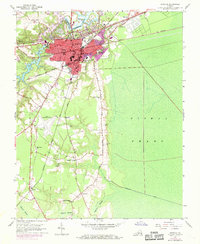
1954 Map of Suffolk
USGS Topo · Published 1969About this map
The Nansemond River and its western tributaries define the landscape of Suffolk, Virginia, at a time when the city was evolving into a regional hub of transport and industry. The city's growth is marked by its complex rail infrastructure, with lines like the Norfolk and Western and Seaboard Coast Line converging on the urban center. To the east, the vast expanse of the Dismal Swamp remains largely untamed, pierced only by artificial waterways like Jericho Ditch and Washington Ditch. In the rural south, small communities and farming settlements such as Skeeter Crossing, Nurney, and Saunders are connected by local routes like Hoosier Road. The map also details essential social foundations for researchers, including the Cedar Hill Cem, East Suffolk High Sch, and various country churches like Balm of Gilead Ch.
Find a feature on this map
46 named features on this map. Tap any name to fly to it.
Don’t see what you’re looking for? This feature index may not catch every label — zoom into the map to look around manually.
Map Details
Editions of this 1954 Suffolk Map
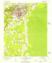
2 editions found
Other maps of this area

1907 · Norfolk
USGS Topo · 1:125,000

1919 · Smithfield
USGS Topo · 1:62,500

1919 · Suffolk
USGS Topo · 1:62,500

1921 · Newport News
USGS Topo · 1:62,500

1940 · Lake Drummond
USGS Topo · 1:62,500

1944 · Windsor
USGS Topo · 1:31,680

1945 · Lake Drummond
USGS Topo · 1:62,500

1949 · Chuckatuck
USGS Topo · 1:24,000
1952 · Bowers Hill
USGS Topo · 1:24,000

1953 · Norfolk
USGS Topo · 1:250,000