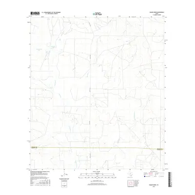
2016 Map of Sugar Creek
USGS Topo · Published 2016About this map
Sugar Cr winds through this South Texas landscape where the boundary of Zavala Co and Dimmit Co divides the range. This 2016 survey highlights a region defined by its hydrography and ranching infrastructure, particularly the numerous man-made water catchments that sustain the area. Several family-named or descriptive reservoirs are prominent, including Garys Tank, John Davis Tank, and Big Manning Tank.
Find a feature on this map
14 named features on this map. Tap any name to fly to it.
Don’t see what you’re looking for? This feature index may not catch every label — zoom into the map to look around manually.
Map Details
Editions of this 2016 Sugar Creek Map
This is the sole edition of this map. No revisions or reprints were ever made.
Other maps of this area

1939 · Big Wells
USGS Topo · 1:62,500

1942 · Divot
USGS Topo · 1:62,500

1953 · Crystal City
USGS Topo · 1:250,000

1955 · Crystal City
USGS Topo · 1:250,000

1956 · Woodward
USGS Topo · 1:62,500

1956 · Divot
USGS Topo · 1:62,500

1957 · Batesville
USGS Topo · 1:62,500

1961 · Crystal City
USGS Topo · 1:250,000

1968 · Crystal City
USGS Topo · 1:250,000
1972 · Big Wells
USGS Topo · 1:24,000