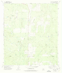
1972 Map of Sugar Creek
USGS Topo · Published 1975About this map
The Big Wells Oil Field dominates the southeastern quadrant of this South Texas landscape, illustrating the industrial footprint of the region's energy sector in the early 1970s. The terrain is defined by a dense network of intermittent drainage systems, including the namesake Sugar Creek and Arroyo Negro, which feed into the larger brush country watershed. Man-made water features are equally prominent, with numerous named stock tanks such as Big Manning Tank and John Davis Tank providing essential water for cattle in an otherwise arid environment.
Find a feature on this map
16 named features on this map. Tap any name to fly to it.
Don’t see what you’re looking for? This feature index may not catch every label — zoom into the map to look around manually.
Map Details
Editions of this 1972 Sugar Creek Map
This is the sole edition of this map. No revisions or reprints were ever made.
Other maps of this area

1939 · Big Wells
USGS Topo · 1:62,500

1942 · Divot
USGS Topo · 1:62,500

1953 · Crystal City
USGS Topo · 1:250,000

1955 · Crystal City
USGS Topo · 1:250,000

1956 · Woodward
USGS Topo · 1:62,500

1956 · Divot
USGS Topo · 1:62,500

1957 · Batesville
USGS Topo · 1:62,500

1961 · Crystal City
USGS Topo · 1:250,000

1968 · Crystal City
USGS Topo · 1:250,000
1972 · Big Wells
USGS Topo · 1:24,000