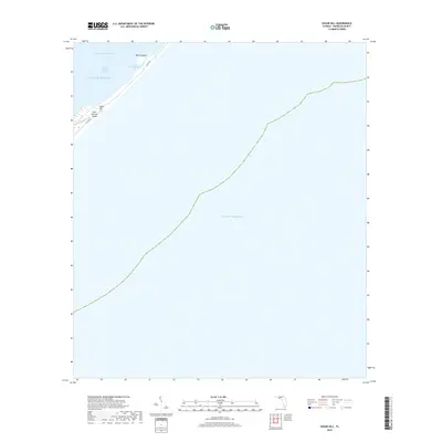
2018 Map of Sugar Hill
USGS Topo · Published 2018About this map
Sugar Hill occupies a narrow stretch of coastal terrain along Saint George Sound, illustrating the delicate transition between the Florida mainland and the open Gulf of Mexico. This 2018 survey documents a landscape defined primarily by water and maritime navigation, where the Intracoastal Waterway cuts through the sounds to facilitate regional boat traffic. Localized features like Pilot Harbor and the adjacent Marsh Island provide specific reference points for those studying the low-lying geography of Franklin County's shoreline. The map focuses heavily on the bathymetry and aquatic boundaries of the sound, showing how small coastal settlements like Sugar Hill are physically situated against the shifting tidal environment of the Florida panhandle.
Find a feature on this map
7 named features on this map. Tap any name to fly to it.
Don’t see what you’re looking for? This feature index may not catch every label — zoom into the map to look around manually.
Map Details
Editions of this 2018 Sugar Hill Map
This is the sole edition of this map. No revisions or reprints were ever made.
Other maps of this area

1943 · Dog Island
USGS Topo · 1:31,680

1943 · Carrabelle
USGS Topo · 1:24,000

1944 · Carrabelle
USGS Topo · 1:31,680

1944 · Green Point
USGS Topo · 1:31,680

1944 · Sugar Hill
USGS Topo · 1:31,680

1945 · Sugar Hill
USGS Topo · 1:31,680

1949 · Apalachicola
USGS Topo · 1:250,000

1950 · Goose Island
USGS Topo · 1:31,680

1957 · Apalachicola
USGS Topo · 1:250,000

1959 · Apalachicola
USGS Topo · 1:250,000