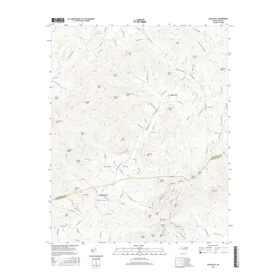
2016 Map of Sugar Hill
USGS Topo · Published 2016About this map
The Second Broad River winds through this landscape on the border of McDowell and Rutherford Counties, anchoring a network of mountain settlements and small family-named landmarks. The village of Sugar Hill sits near the headwaters of Morgan Cr, while further south, the community of Whitehouse serves as a focal point for local history researchers. This area is characterized by significant topographic relief, featuring prominent peaks like Hickorynut Mtn, Sandy Knob, and Grassy Mtn. Genealogists will find particular value in the documentation of several local burial sites, including the Montford Cove Church Cem and the Welcome Home Church Cem. The map traces numerous gaps and ridges, such as Two Inch Gap and Ledbetter Ridge, which historically dictated the paths of travel and commerce through these highlands. A dense network of creeks, including Cove Cr and Catheys Cr, drains the complex terrain, illustrating the water-driven geography of the North Carolina foothills.
Find a feature on this map
151 named features on this map. Tap any name to fly to it.
Don’t see what you’re looking for? This feature index may not catch every label — zoom into the map to look around manually.
Map Details
Editions of this 2016 Sugar Hill Map
This is the sole edition of this map. No revisions or reprints were ever made.
Other maps of this area

1900 · Mount Mitchell
USGS Topo · 1:125,000

1902 · Mount Mitchell
USGS Topo · 1:125,000

1905 · Morganton
USGS Topo · 1:125,000

1907 · Saluda
USGS Topo · 1:125,000

1934 · Parts Of Old Fort and Montreat
USGS Topo · 1:24,000

1953 · Charlotte
USGS Topo · 1:250,000

1954 · Charlotte
USGS Topo · 1:250,000

1955 · Knoxville
USGS Topo · 1:250,000

1957 · Knoxville
USGS Topo · 1:250,000

1959 · Lake Lure
USGS Topo · 1:62,500