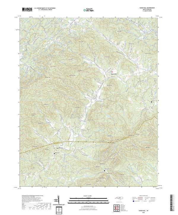
2022 Map of Sugar Hill
USGS Topo · Published 2022About this map
Sugar Hill sits at the center of this mountain landscape where the Second Broad River and its various tributaries, including Hicks Br and Wilson Br, carve through the complex terrain of the Blue Ridge foothills. The map documents a rural community defined by its topography, with numerous family-named peaks and ridges such as Harris Mtn, Piney Mtn, and Elliot Mtn shaping the movement of roads and water.
Find a feature on this map
151 named features on this map. Tap any name to fly to it.
Don’t see what you’re looking for? This feature index may not catch every label — zoom into the map to look around manually.
Map Details
Editions of this 2022 Sugar Hill Map
This is the sole edition of this map. No revisions or reprints were ever made.
Other maps of this area

1900 · Mount Mitchell
USGS Topo · 1:125,000

1902 · Mount Mitchell
USGS Topo · 1:125,000

1905 · Morganton
USGS Topo · 1:125,000

1907 · Saluda
USGS Topo · 1:125,000

1934 · Parts Of Old Fort and Montreat
USGS Topo · 1:24,000

1953 · Charlotte
USGS Topo · 1:250,000

1954 · Charlotte
USGS Topo · 1:250,000

1955 · Knoxville
USGS Topo · 1:250,000

1957 · Knoxville
USGS Topo · 1:250,000

1959 · Lake Lure
USGS Topo · 1:62,500