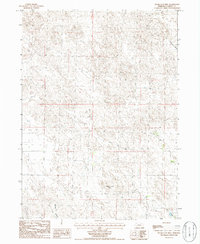
1986 Map of Sugar Loaf Hill
USGS Topo · Published 1986About this map
Sugar Loaf Hill stands as a prominent landmark in this segment of the Nebraska Sandhills, overlooking a landscape defined by intermittent water sources and vast cattle ranges. The 1986 survey reveals a sparse human footprint in the southern portion of the county, where the drainages of Mutton Creek and Lost Creek wind through the shifting terrain. Evidence of early settlement and ranching life is found in isolated features such as a remote Cem, providing a valuable point of reference for genealogists tracing family lands in this region. To the north, the broad expanse of Dogtown Flats suggests the open, level character of the plateau. This provisional map, compiled from 1980s aerial photography, documents the vital network of wells and tracks that sustained agriculture in a high-plains environment where surface water was often seasonal.
Find a feature on this map
8 named features on this map. Tap any name to fly to it.
Don’t see what you’re looking for? This feature index may not catch every label — zoom into the map to look around manually.
Map Details
Editions of this 1986 Sugar Loaf Hill Map
This is the sole edition of this map. No revisions or reprints were ever made.
Other maps of this area

1896 · Browns Creek
USGS Topo · 1:125,000

1899 · Browns Creek
USGS Topo · 1:125,000

1899 · Sidney
USGS Topo · 1:125,000

1900 · Chappell
USGS Topo · 1:125,000

1950 · Crescent Lake
USGS Topo · 1:62,500

1954 · Scottsbluff
USGS Topo · 1:250,000

1958 · Scottsbluff
USGS Topo · 1:250,000

1971 · Richardson Lake
USGS Topo · 1:24,000

1971 · Coumbe Bluff
USGS Topo · 1:24,000
1971 · Buske Ranch
USGS Topo · 1:24,000