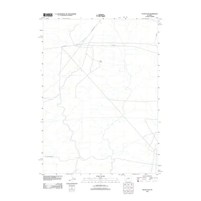
2012 Map of Sugar Loaf
USGS Topo · Published 2012About this map
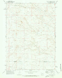
The California-Oregon Trl cuts across the lower portion of this landscape, marking a historic corridor of western migration through Sweetwater County. This high-desert terrain is characterized by its sparse infrastructure and open drainages, centered on the prominent topographic feature of Sugar Loaf. The map illustrates a network of functional Bureau of Land Management routes, including B L M 4205 Rd and B L M 5407, which serve the expansive public lands in this part of Wyoming. Modern access is facilitated by Yellow Point Rd, which intersects with several unimproved tracks. The survey reflects a region primarily used for grazing and resource management, where the deep history of the overland trail system remains a visible part of the contemporary geographical record.
Find a feature on this map
5 named features on this map. Tap any name to fly to it.
Don’t see what you’re looking for? This feature index may not catch every label — zoom into the map to look around manually.
Map Details
Editions of this 2012 Sugar Loaf Map
This is the sole edition of this map. No revisions or reprints were ever made.
Other maps of this area

1955 · Lander
USGS Topo · 1:250,000

1958 · Lander
USGS Topo · 1:250,000

1961 · Lander
USGS Topo · 1:250,000

1968 · Twelvemile Knoll
USGS Topo · 1:24,000
1968 · Monument Butte NE
USGS Topo · 1:24,000
1968 · Monument Butte
USGS Topo · 1:24,000

1969 · Oasis Well
USGS Topo · 1:24,000
1969 · Sugar Loaf
USGS Topo · 1:24,000
1969 · Teakettle Butte
USGS Topo · 1:24,000
1969 · Sugar Loaf NW
USGS Topo · 1:24,000