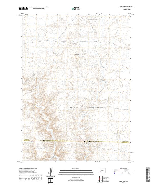
2021 Map of Sugar Loaf
USGS Topo · Published 2021About this map
California-Oregon Trl cuts across the southern portion of this high desert landscape, marking the enduring path of westward migration through Wyoming. The terrain is characterized by broad elevations and natural drainage patterns like East Buckhorn Draw, located in the northeast corner of the quadrangle. A central prominence known as Sugar Loaf stands as a primary navigational landmark for the surrounding territory. Mapping here reflects the modern management of public lands, with transportation routes such as Yellow Point Rd and BLM Rd 4205 providing access through the open range. The map also delineates the jurisdictional boundary between Sublette Co and Sweetwater Co, highlighting the intersection of historical trails and current administrative divisions.
Find a feature on this map
12 named features on this map. Tap any name to fly to it.
Don’t see what you’re looking for? This feature index may not catch every label — zoom into the map to look around manually.
Map Details
Editions of this 2021 Sugar Loaf Map
This is the sole edition of this map. No revisions or reprints were ever made.
Other maps of this area

1955 · Lander
USGS Topo · 1:250,000

1958 · Lander
USGS Topo · 1:250,000

1961 · Lander
USGS Topo · 1:250,000

1968 · Twelvemile Knoll
USGS Topo · 1:24,000
1968 · Monument Butte NE
USGS Topo · 1:24,000
1968 · Monument Butte
USGS Topo · 1:24,000

1969 · Oasis Well
USGS Topo · 1:24,000
1969 · Sugar Loaf
USGS Topo · 1:24,000
1969 · Teakettle Butte
USGS Topo · 1:24,000
1969 · Sugar Loaf NW
USGS Topo · 1:24,000