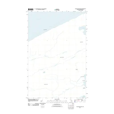
2011 Map of Sugar Mountain
USGS Topo · Published 2011About this map
Sugar Mountain and Mount Desor dominate the interior of this island landscape, part of a complex topography shaped by ridges and glacial water bodies. The terrain is defined by a series of parallel elevations, most notably Red Oak Ridge, which separate the drainage of Grace Creek and Washington Creek. These waterways, along with the Little Siskiwit River and Big Siskiwit River, flow through a landscape largely untouched by modern development, terminating near the shores of Lake Superior and Siskiwit Bay.
Find a feature on this map
18 named features on this map. Tap any name to fly to it.
Don’t see what you’re looking for? This feature index may not catch every label — zoom into the map to look around manually.
Map Details
Editions of this 2011 Sugar Mountain Map
This is the sole edition of this map. No revisions or reprints were ever made.
Other maps of this area

1958 · Hancock
USGS Topo · 1:250,000

1959 · Fort William
USGS Topo · 1:250,000

1960 · Hancock
USGS Topo · 1:250,000

1961 · Hancock
USGS Topo · 1:250,000

1966 · Hancock
USGS Topo · 1:250,000

1968 · Fort William
USGS Topo · 1:250,000

1985 · Todd Harbor
USGS Topo · 1:100,000

1985 · Pigeon Point
USGS Topo · 1:100,000

1985 · Siskiwit Bay
USGS Topo · 1:100,000

1985 · Grand Portage
USGS Topo · 1:100,000