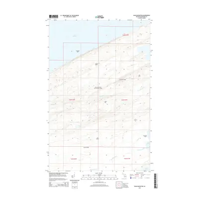
2014 Map of Sugar Mountain
USGS Topo · Published 2014About this map
Isle Royale National Park dominates this landscape, defined by the linear orientation of its volcanic ridges and valleys. The spine of the island is traced by Greenstone Ridge, while Minong Ridge and Red Oak Ridge run parallel, creating a distinct topographical rhythm that dictates the flow of water on this remote part of Michigan. The high points of Mt Desor and Sugar Mtn rise above the surrounding terrain, offering a look at the wilderness interior as it remained in the early 21st century. The map also documents the drainage patterns of the Big Siskiwit River and Little Siskiwit River, which move toward the coast of Lake Superior. Historical sites like the Isle Royale Cem provide a human connection to the island's isolated past, while features like Lily Lake and Carnelian Beach mark specific points of interest along the shoreline and interior trails.
Find a feature on this map
23 named features on this map. Tap any name to fly to it.
Don’t see what you’re looking for? This feature index may not catch every label — zoom into the map to look around manually.
Map Details
Editions of this 2014 Sugar Mountain Map
This is the sole edition of this map. No revisions or reprints were ever made.
Other maps of this area

1958 · Hancock
USGS Topo · 1:250,000

1959 · Fort William
USGS Topo · 1:250,000

1960 · Hancock
USGS Topo · 1:250,000

1961 · Hancock
USGS Topo · 1:250,000

1966 · Hancock
USGS Topo · 1:250,000

1968 · Fort William
USGS Topo · 1:250,000

1985 · Todd Harbor
USGS Topo · 1:100,000

1985 · Pigeon Point
USGS Topo · 1:100,000

1985 · Siskiwit Bay
USGS Topo · 1:100,000

1985 · Grand Portage
USGS Topo · 1:100,000