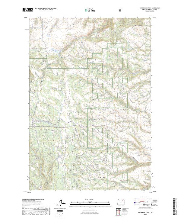
2023 Map of Sugarbowl Creek
USGS Topo · Published 2023About this map
Umatilla National Forest spans a rugged landscape of ridges and drainage basins in this high-country survey of Umatilla County. The terrain is defined by the prominent Sugarbowl Ridge and the distinct volcanic or glacial depression known as The Big Pot. A network of historic pathways, such as the Old Western Route Trl and the Gilman Ranch Trl, suggests a legacy of ranching and livestock movement through these timbered uplands. The area is heavily defined by its hydrography, with numerous water sources like Guilford Spring and Wolf Spring feeding the headwaters of Sugarbowl Creek and Deerlick Creek. This modern survey documents the contemporary boundaries of the national forest alongside enduring geographic landmarks like Battle Mtn.
Find a feature on this map
30 named features on this map. Tap any name to fly to it.
Don’t see what you’re looking for? This feature index may not catch every label — zoom into the map to look around manually.
Map Details
Editions of this 2023 Sugarbowl Creek Map
This is the sole edition of this map. No revisions or reprints were ever made.
Other maps of this area

1953 · Pendleton
USGS Topo · 1:250,000

1956 · Pendleton
USGS Topo · 1:250,000

1967 · Bridge Creek
USGS Topo · 1:24,000

1967 · Carney Butte
USGS Topo · 1:24,000

1967 · Ukiah
USGS Topo · 1:24,000

1968 · Hoodlum Canyon
USGS Topo · 1:24,000

1968 · Gurdane
USGS Topo · 1:24,000

1969 · Sugarbowl Creek
USGS Topo · 1:24,000

1969 · Deerhorn Creek
USGS Topo · 1:24,000

1969 · Thompson Flat
USGS Topo · 1:24,000