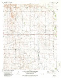
1979 Map of Sugarloaf
USGS Topo · Published 1986About this map
Atchison Topeka and Santa Fe railroad tracks slice across the heart of this landscape, marking the industrial connectivity of the High Plains in the late 1970s. The terrain is defined by the deep incisions of Bluff Creek, which meanders through the northeast and southeast corners, creating a stark contrast to the surrounding upland flats. This survey documents the energy and extractive footprint of the era, notably the presence of the Sitka Gas Field and scattered industrial markers like a Drill Hole and a Sandpit. The boundary between Clark and Comanche counties runs vertically through the eastern half of the sheet, while the name Protection appears as a large regional label in the east, reflecting the proximity of local centers. It is a snapshot of Kansas rangeland where resource extraction and rail transport have long shaped the local economy.
Find a feature on this map
7 named features on this map. Tap any name to fly to it.
Don’t see what you’re looking for? This feature index may not catch every label — zoom into the map to look around manually.
Map Details
Editions of this 1979 Sugarloaf Map
2 editions found
Other maps of this area

1892 · Coldwater
USGS Topo · 1:125,000

1894 · Sitka
USGS Topo · 1:62,500

1896 · Ashland
USGS Topo · 1:125,000

1955 · Pratt
USGS Topo · 1:250,000

1959 · Pratt
USGS Topo · 1:250,000

1979 · Sitka
USGS Topo · 1:24,000

1979 · Sugarloaf
USGS Topo · 1:24,000

1979 · East Kiowa Creek South
USGS Topo · 1:24,000
1979 · Sitka SW
USGS Topo · 1:24,000
1979 · Lexington
USGS Topo · 1:24,000