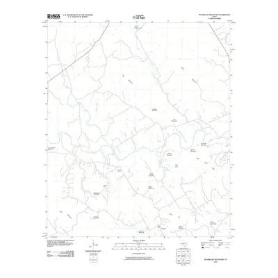
2010 Map of Sugarloaf Mountain
USGS Topo · Published 2010About this map
The Upper Settlement Rural Historic District anchor this landscape, preserving the heritage of the Norwegian immigrants who settled this portion of Bosque County. The map provides an exceptionally detailed look at the rural farmstead tradition, naming numerous specific family properties such as the Even and Petrine Erickson Farm, the Carl and Sedsel Questad Farm, and the Christen and Johanne Knudson Farm. These named farms reflect a stable agricultural legacy that persists near the small community of Norse.
Find a feature on this map
31 named features on this map. Tap any name to fly to it.
Don’t see what you’re looking for? This feature index may not catch every label — zoom into the map to look around manually.
Map Details
Editions of this 2010 Sugarloaf Mountain Map
This is the sole edition of this map. No revisions or reprints were ever made.
Other maps of this area

1888 · Meridian
USGS Topo · 1:125,000

1894 · Meridian
USGS Topo · 1:125,000

1954 · Waco
USGS Topo · 1:250,000

1955 · Waco
USGS Topo · 1:250,000

1955 · Clifton
USGS Topo · 1:24,000

1955 · Meridian
USGS Topo · 1:24,000
1955 · Pilot Knob
USGS Topo · 1:24,000
1956 · Hurst Spring
USGS Topo · 1:24,000

1956 · Cranfills Gap
USGS Topo · 1:24,000
1956 · Mosheim
USGS Topo · 1:24,000