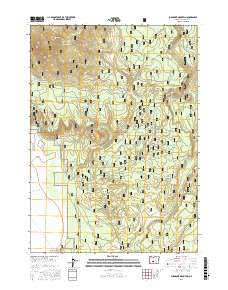
2017 Map of Sugarpine Mountain
USGS Topo · Published 2017About this map
Winema National Forest and the Klamath Marsh National Wildlife Refuge dominate this high-elevation landscape in south-central Oregon. The western edge of the map follows the distinctive transition into the Klamath Marsh, while the interior terrain is marked by significant volcanic landmarks including Sugarpine Mtn and God Butte. A complex network of Forest Service roads, such as Nat For Dev Rd 86 and Nat For Dev Rd 8820, provides access to numerous seasonal water sources and meadows used by local wildlife and early stockmen. Named landmarks like Paddys Meadow, O'Conner Meadow, and Indian Spring indicate a terrain where water management and seasonal grazing were historically vital. The southernmost reaches include Sagebrush Point near the corridor of Silver Lake Rd.
Find a feature on this map
36 named features on this map. Tap any name to fly to it.
Don’t see what you’re looking for? This feature index may not catch every label — zoom into the map to look around manually.
Map Details
Editions of this 2017 Sugarpine Mountain Map
This is the sole edition of this map. No revisions or reprints were ever made.
Other maps of this area

1889 · Klamath
USGS Topo · 1:250,000

1894 · Klamath
USGS Topo · 1:250,000

1935 · Chemult
USGS Topo · 1:96,000

1941 · Chemult
USGS Topo · 1:125,000

1955 · Crescent
USGS Topo · 1:250,000

1955 · Klamath Falls
USGS Topo · 1:250,000

1957 · Crescent
USGS Topo · 1:250,000

1957 · Klamath Marsh
USGS Topo · 1:62,500

1958 · Crescent
USGS Topo · 1:250,000

1958 · Klamath Falls
USGS Topo · 1:250,000