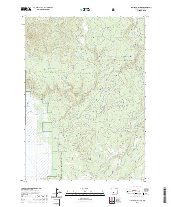
2023 Map of Sugarpine Mountain
USGS Topo · Published 2023About this map
Klamath Marsh National Wildlife Refuge and the Winema National Forest dominate this Klamath County landscape, where the high desert meets the seasonal wetlands of the eastern Cascades. The terrain is defined by volcanic features and significant hydrological markers, from the heights of Sugarpine Mtn and God Butte down to the sprawling Klamath Marsh. Numerous meadows and springs suggest a history of seasonal grazing and movement through the high country, with named points like Paddys Meadow, Rakes Meadow, and Conner Meadow serving as important landmarks for local navigation. A network of springs, including Surveyors Spring and Indian Spring, feeds the headwaters of Mosquito Creek and Jack Creek, which drain toward the marsh. At the southern edge, Sagebrush Point overlooks the lower basins near Silver Lake Road-C.R. 6.
Find a feature on this map
27 named features on this map. Tap any name to fly to it.
Don’t see what you’re looking for? This feature index may not catch every label — zoom into the map to look around manually.
Map Details
Editions of this 2023 Sugarpine Mountain Map
This is the sole edition of this map. No revisions or reprints were ever made.
Other maps of this area

1889 · Klamath
USGS Topo · 1:250,000

1894 · Klamath
USGS Topo · 1:250,000

1935 · Chemult
USGS Topo · 1:96,000

1941 · Chemult
USGS Topo · 1:125,000

1955 · Crescent
USGS Topo · 1:250,000

1955 · Klamath Falls
USGS Topo · 1:250,000

1957 · Crescent
USGS Topo · 1:250,000

1957 · Klamath Marsh
USGS Topo · 1:62,500

1958 · Crescent
USGS Topo · 1:250,000

1958 · Klamath Falls
USGS Topo · 1:250,000