
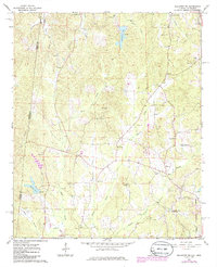
1967 Map of Sulligent SW
USGS Topo · Published 1968About this map
The Alabama and Mississippi state line runs vertically through this rural landscape in the late 1960s, a region defined by its reliance on small community centers and an extensive network of creeks. In this corner of Lamar County, numerous congregations such as Pleasant Ridge Ch, Hilltop Ch, and Rising Star Ch provided social anchors for the surrounding residents. Educational life centered around the Bedford Sch, while the presence of scattered Gravel Pits points to the local extraction industry of the era.
Find a feature on this map
35 named features on this map. Tap any name to fly to it.
Don’t see what you’re looking for? This feature index may not catch every label — zoom into the map to look around manually.
Map Details
Editions of this 1967 Sulligent SW Map
2 editions found
Other maps of this area

1953 · West Point
USGS Topo · 1:250,000

1958 · West Point
USGS Topo · 1:250,000

1960 · Caledonia
USGS Topo · 1:62,500

1963 · West Point
USGS Topo · 1:250,000

1966 · Greenwood Springs
USGS Topo · 1:24,000

1966 · Amory SE
USGS Topo · 1:24,000

1967 · Sulligent
USGS Topo · 1:24,000

1967 · Beaverton
USGS Topo · 1:24,000

1967 · Hightogy
USGS Topo · 1:24,000

1967 · Millport NW
USGS Topo · 1:24,000