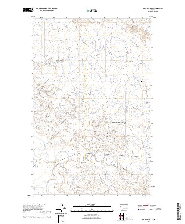
2024 Map of Sullivan Coulee
USGS Topo · Published 2024About this map
The Redwater River snakes through the southern reaches of this landscape, carving a low-lying valley through the high plains of Eastern Montana. This 2024 survey captures the sparse, open character of the borderlands between McCone and Richland Counties, where the terrain is defined by a network of drainage channels including Sullivan Coulee, Milne Coulee, and Davis Coulee. Human presence is marked by a precise grid of rural roads such as Sunnyside Rd and Doornek Rd, which connect remote homesteads and section lines.
Find a feature on this map
22 named features on this map. Tap any name to fly to it.
Don’t see what you’re looking for? This feature index may not catch every label — zoom into the map to look around manually.
Map Details
Editions of this 2024 Sullivan Coulee Map
This is the sole edition of this map. No revisions or reprints were ever made.
Other maps of this area

1912 · Chelsea
USGS Topo · 1:62,500

1912 · Poplar
USGS Topo · 1:62,500

1954 · Glendive
USGS Topo · 1:250,000

1954 · Wolf Point
USGS Topo · 1:250,000

1957 · Glendive
USGS Topo · 1:250,000

1958 · Wolf Point
USGS Topo · 1:250,000

1958 · Glendive
USGS Topo · 1:250,000

1972 · Poplar
USGS Topo · 1:24,000
1972 · Nickwall
USGS Topo · 1:24,000
1972 · Sprole
USGS Topo · 1:24,000