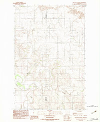
1983 Map of Sullivan Coulee
USGS Topo · Published 1983About this map
The Redwater River and its meandering tributaries carve through the boundary of Richland and McCone counties in this 1983 provisional survey. The landscape is defined by an intricate network of drainage systems, including the prominent Sullivan Coulee and Davis Coulee, which shape the local topography. This era of mapping captured the rural character of the Montana plains before significant modern alterations, showing the relationship between the major waterway and its smaller offshoots like East Redwater Creek and Milne Coulee. The presence of Muskrat Creek in the eastern portion of the quadrangle highlights the complex hydrology of this drainage basin, which has long influenced land use and cattle ranching patterns in this part of eastern Montana.
Find a feature on this map
8 named features on this map. Tap any name to fly to it.
Don’t see what you’re looking for? This feature index may not catch every label — zoom into the map to look around manually.
Map Details
Editions of this 1983 Sullivan Coulee Map
This is the sole edition of this map. No revisions or reprints were ever made.
Other maps of this area

1912 · Chelsea
USGS Topo · 1:62,500

1912 · Poplar
USGS Topo · 1:62,500

1954 · Glendive
USGS Topo · 1:250,000

1954 · Wolf Point
USGS Topo · 1:250,000

1957 · Glendive
USGS Topo · 1:250,000

1958 · Wolf Point
USGS Topo · 1:250,000

1958 · Glendive
USGS Topo · 1:250,000

1972 · Poplar
USGS Topo · 1:24,000
1972 · Nickwall
USGS Topo · 1:24,000
1972 · Sprole
USGS Topo · 1:24,000