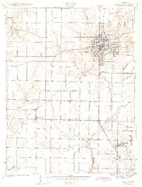
1943 Map of Sullivan
USGS Topo · Published 1943About this map
Sullivan serves as the focal point of this 1941 survey, revealing the structured street grid and early industrial layout of the county seat just before the mid-century. The town's economic reliance on transportation is evident in the intersection of the Illinois Central and the Chicago and Eastern Illinois railroads, with Depot Town marking a key transit point. Beyond the urban center, the landscape is defined by the winding course of Busseron Creek and its tributaries, such as Buttermilk Cr and Robbins Branch. The map preserves the locations of numerous family and community landmarks, including the County Farm, the Landing Field, and small rural congregations like Liberty Ch. Genealogists will find the density of named burial grounds particularly useful, ranging from the Sullivan Jackson Cem to more remote sites like Morgan Cem and Parson Cem.
Find a feature on this map
41 named features on this map. Tap any name to fly to it.
Don’t see what you’re looking for? This feature index may not catch every label — zoom into the map to look around manually.
Map Details
Editions of this 1943 Sullivan Map
2 editions found
Other maps of this area

1917 · Birds
USGS Topo · 1:62,500

1942 · Fairbanks
USGS Topo · 1:24,000

1942 · Shelburn
USGS Topo · 1:24,000

1942 · Birds
USGS Topo · 1:62,500

1943 · Merom
USGS Topo · 1:24,000

1943 · Hymera
USGS Topo · 1:24,000

1943 · Carlisle
USGS Topo · 1:24,000

1943 · Sullivan
USGS Topo · 1:24,000

1943 · Dugger
USGS Topo · 1:24,000

1944 · Bucktown
USGS Topo · 1:24,000