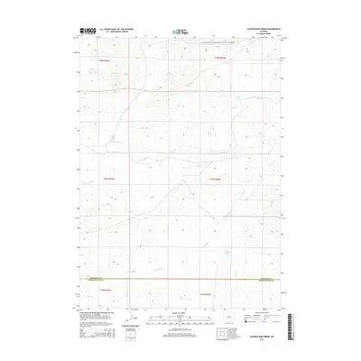
2015 Map of Sulphur Bar Spring
USGS Topo · Published 2015About this map
Sulphur Bar Spring and other vital water sources define this high-altitude landscape where the Fremont Co Sweetwater Co line divides the terrain. This high desert environment is characterized by a complex network of seasonal drainages, including the N Fork Sulphur Cr, S Fork Sulphur Cr, and the main stem of Sulphur Cr. The importance of water in this arid region is marked by named locations like Mitten Springs, Arnold Spring, and the isolated Daley Lake to the south.
Find a feature on this map
17 named features on this map. Tap any name to fly to it.
Don’t see what you’re looking for? This feature index may not catch every label — zoom into the map to look around manually.
Map Details
Editions of this 2015 Sulphur Bar Spring Map
This is the sole edition of this map. No revisions or reprints were ever made.
Other maps of this area

1953 · Lewiston Lakes
USGS Topo · 1:24,000

1953 · Barras Springs
USGS Topo · 1:24,000

1953 · Happy Spring
USGS Topo · 1:24,000

1955 · Lander
USGS Topo · 1:250,000

1958 · Lander
USGS Topo · 1:250,000

1960 · Five Fingers Butte
USGS Topo · 1:62,500

1960 · Lost Creek Lake
USGS Topo · 1:62,500

1961 · Lander
USGS Topo · 1:250,000
1961 · Olson Springs
USGS Topo · 1:24,000
1961 · Picket Lake
USGS Topo · 1:24,000