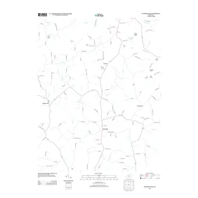
2013 Map of Sulphur Lick
USGS Topo · Published 2013About this map
Skaggs Cr and its many tributaries carve through this central Monroe County landscape, defining a rural network of small communities and family farmsteads. The settlements of Rockbridge, Sulphur Lick, Cyclone, and Persimmon serve as the primary anchors for the area, connected by winding routes like N Page Rd and Old Sulpher Lick Rd. The high density of family cemeteries, including Wade Cem and Mosier Cem, highlights the long-standing genealogical roots of this region. Terrain features such as Piercy Hollow and Flood Catcher Hollow demonstrate the intricate drainage patterns feeding into the E Fork Barren River. This 2013 survey preserves the mid-century schoolhouse locations and established road names that reveal the local history of these close-knit Kentucky neighborhoods before further modern development shifted the agricultural footprint.
Find a feature on this map
112 named features on this map. Tap any name to fly to it.
Don’t see what you’re looking for? This feature index may not catch every label — zoom into the map to look around manually.
Map Details
Editions of this 2013 Sulphur Lick Map
This is the sole edition of this map. No revisions or reprints were ever made.
Other maps of this area

1929 · Tompkinsville
USGS Topo · 1:62,500

1931 · Red Boiling Springs
USGS Topo · 1:62,500

1953 · Sulphur Lick
USGS Topo · 1:24,000

1953 · Temple Hill
USGS Topo · 1:24,000

1953 · Freedom
USGS Topo · 1:24,000

1953 · Edmonton
USGS Topo · 1:24,000

1953 · Summer Shade
USGS Topo · 1:24,000

1953 · Dubre
USGS Topo · 1:24,000

1954 · Gamaliel
USGS Topo · 1:24,000

1954 · Tompkinsville
USGS Topo · 1:24,000