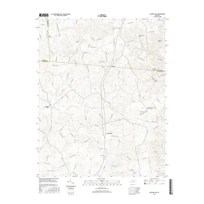
2016 Map of Sulphur Lick
USGS Topo · Published 2016About this map
Cyclone and Sulphur Lick anchor this transition zone between Barren, Metcalfe, and Monroe counties, where the Kentucky landscape is defined by a dense network of hollows and creek branches. The topography is marked by named drainage features like Flood Catcher Hollow and Anderson Hollow, which feed into larger water bodies such as Skaggs Cr and the E Fork Barren River. The settlement pattern follows the high ridges and valley floors, connected by a web of local roads named for established families, including George Lynn Rd and Harold Paull Rd. Local genealogy is well-preserved through numerous small burial sites like Wade Cem and Dubre Cem. The map illustrates the 21st-century persistence of small rural communities like Rockbridge and Persimmon, showing how geographic features like Nobob Cr and Marrowbone Cr have historically dictated the placement of homesteads and connecting routes.
Find a feature on this map
110 named features on this map. Tap any name to fly to it.
Don’t see what you’re looking for? This feature index may not catch every label — zoom into the map to look around manually.
Map Details
Editions of this 2016 Sulphur Lick Map
This is the sole edition of this map. No revisions or reprints were ever made.
Other maps of this area

1929 · Tompkinsville
USGS Topo · 1:62,500

1931 · Red Boiling Springs
USGS Topo · 1:62,500

1953 · Sulphur Lick
USGS Topo · 1:24,000

1953 · Temple Hill
USGS Topo · 1:24,000

1953 · Freedom
USGS Topo · 1:24,000

1953 · Edmonton
USGS Topo · 1:24,000

1953 · Summer Shade
USGS Topo · 1:24,000

1953 · Dubre
USGS Topo · 1:24,000

1954 · Gamaliel
USGS Topo · 1:24,000

1954 · Tompkinsville
USGS Topo · 1:24,000