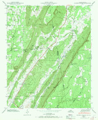
1946 Map of Sulphur Springs
USGS Topo · Published 1970About this map
Lookout Mountain and Sand Mountain dominate this mid-century landscape along the Alabama-Georgia border, where the Southern Railroad navigates the narrow corridor of Little River Valley. The terrain is defined by deep incisions like Deer Head Cove and Dean Gulf, with small rural communities and industrial nodes scattered between the ridges. The geography of the late 1940s is reflected in names like Battelle and Kaolin, indicating the area's geological and extractive history.
Find a feature on this map
46 named features on this map. Tap any name to fly to it.
Don’t see what you’re looking for? This feature index may not catch every label — zoom into the map to look around manually.
Map Details
Editions of this 1946 Sulphur Springs Map
3 editions found
Other maps of this area

1886 · Ringgold
USGS Topo · 1:125,000

1886 · Stevenson
USGS Topo · 1:125,000

1892 · Ringgold
USGS Topo · 1:125,000

1892 · Stevenson
USGS Topo · 1:125,000

1895 · Stevenson
USGS Topo · 1:125,000

1935 · Durham
USGS Topo · 1:24,000

1936 · Trenton
USGS Topo · 1:24,000

1936 · Ider
USGS Topo · 1:24,000

1936 · Flat Rock
USGS Topo · 1:24,000

1936 · Dugout Valley
USGS Topo · 1:24,000