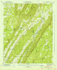
1947 Map of Sulphur Springs
USGS Topo · Published 1947About this map
Lookout Mountain and Sand Mountain dominate this 1947 survey of the Alabama-Georgia borderlands, where the steep topography of Big Ridge and Little River Ridge dictates the path of human settlement. The Southern Railway and the Tennessee Alabama And Georgia corridor follow the valley floors, connecting small communities like Sulphur Springs and Battelle. This era shows a landscape deeply rooted in its geography, with numerous country churches such as Bethlehem Ch, Lookout Chapel, and Head River Ch serving the upland ridges and fertile coves.
Find a feature on this map
85 named features on this map. Tap any name to fly to it.
Don’t see what you’re looking for? This feature index may not catch every label — zoom into the map to look around manually.
Map Details
Editions of this 1947 Sulphur Springs Map
2 editions found
Other maps of this area

1886 · Ringgold
USGS Topo · 1:125,000

1886 · Stevenson
USGS Topo · 1:125,000

1892 · Ringgold
USGS Topo · 1:125,000

1892 · Stevenson
USGS Topo · 1:125,000

1895 · Stevenson
USGS Topo · 1:125,000

1935 · Durham
USGS Topo · 1:24,000

1936 · Trenton
USGS Topo · 1:24,000

1936 · Ider
USGS Topo · 1:24,000

1936 · Flat Rock
USGS Topo · 1:24,000

1936 · Dugout Valley
USGS Topo · 1:24,000