2022 Map of Sulphur Springs
USGS Topo · Published 2022About this map
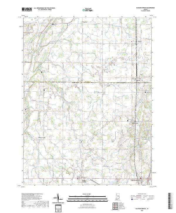
Sulphur Springs sits at the intersection of local routes in this portion of rural Henry County, characterized by a dense network of country roads and small farming communities. The landscape is defined by its many small watercourses, such as Williams Cr and Fall Cr, which wind through the agricultural sections between established villages. Notable local centers include Springport and Mount Summit, while smaller crossroads like Progress and Honey Creek highlight the historical density of the settlement pattern. Genealogists will find a wealth of local markers, including Sunderland Cem, Sharp Cem, and Beech Grove Cem. Further north, across the line into Delaware County, the communities of Oakville and Cowan appear. A distinctive modern landmark, The Last Resort Airport, is positioned near the center of the sheet, illustrating the continued use of private airfields in this part of Indiana.
Find a feature on this map
102 named features on this map. Tap any name to fly to it.
Don’t see what you’re looking for? This feature index may not catch every label — zoom into the map to look around manually.
Map Details
Editions of this 2022 Sulphur Springs Map
This is the sole edition of this map. No revisions or reprints were ever made.
Historical Maps of Progress Through Time
1 maps found