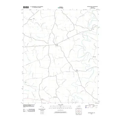
2010 Map of Sulphur Well
USGS Topo · Published 2010About this map
The South Fork Little Barren River winds through this rural landscape, serving as a primary geographic anchor for small communities and family farmsteads in Metcalfe County. Small crossroads settlements like Savoyard, Knob Lick, and Sulphur Well are connected by a network of local roads that bear the names of long-established families, such as Edwin Williams Rd and Mitchell Edwards Rd. To the northwest, the Buck Hill Cemetery stands near the headwaters of Ten Acre Branch, providing a significant point for genealogical research. The mapping of minor waterways like Blue Spring Creek and Dry Fork Creek illustrates the intricate drainage patterns of the region's undulating terrain. This 2010 update documents the enduring rural character of these hamlets, from Echo in the southwest to the eastern settlement of Beechville.
Find a feature on this map
61 named features on this map. Tap any name to fly to it.
Don’t see what you’re looking for? This feature index may not catch every label — zoom into the map to look around manually.
Map Details
Editions of this 2010 Sulphur Well Map
This is the sole edition of this map. No revisions or reprints were ever made.
Other maps of this area

1935 · Horse Cave
USGS Topo · 1:48,000

1938 · Horse Cave
USGS Topo · 1:62,500

1953 · Sulphur Well
USGS Topo · 1:24,000

1953 · Temple Hill
USGS Topo · 1:24,000

1953 · Edmonton
USGS Topo · 1:24,000

1953 · Summer Shade
USGS Topo · 1:24,000

1953 · Exie
USGS Topo · 1:24,000

1953 · Center
USGS Topo · 1:24,000

1953 · East Fork
USGS Topo · 1:24,000

1954 · Park
USGS Topo · 1:24,000