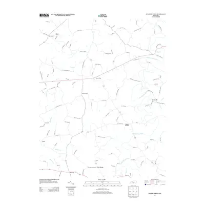
2013 Map of Sulphur Well
USGS Topo · Published 2013About this map
Sulphur Well and Knob Lick anchor this Metcalfe County landscape, where the S Fork Little Barren River carves through the central terrain. The settlement pattern remains largely rural and decentralized, defined by numerous family-named roads like Ratliff Mitchell Rd and Joe Bailey Rd, which suggest long-standing generational landholdings. Small communities such as Beechville and Clarks Corner serve as local crossroads, while scattered burial sites like Nunn Cem and Buck Hill Cem provide specific points of interest for genealogical research.
Find a feature on this map
100 named features on this map. Tap any name to fly to it.
Don’t see what you’re looking for? This feature index may not catch every label — zoom into the map to look around manually.
Map Details
Editions of this 2013 Sulphur Well Map
This is the sole edition of this map. No revisions or reprints were ever made.
Other maps of this area

1935 · Horse Cave
USGS Topo · 1:48,000

1938 · Horse Cave
USGS Topo · 1:62,500

1953 · Sulphur Well
USGS Topo · 1:24,000

1953 · Temple Hill
USGS Topo · 1:24,000

1953 · Edmonton
USGS Topo · 1:24,000

1953 · Summer Shade
USGS Topo · 1:24,000

1953 · Exie
USGS Topo · 1:24,000

1953 · Center
USGS Topo · 1:24,000

1953 · East Fork
USGS Topo · 1:24,000

1954 · Park
USGS Topo · 1:24,000