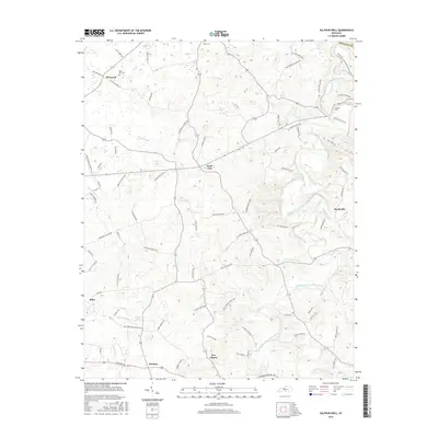
2016 Map of Sulphur Well
USGS Topo · Published 2016About this map
Sulphur Well and the surrounding Metcalfe County landscape are defined by the winding course of the South Fork Little Barren River and its numerous tributaries. This 2016 survey illustrates a rural Kentucky region marked by scattered crossroads settlements like Knob Lick, Savoyard, and Beechville. The mapping of small water features such as Big Blue Spring, Ten Acre Br, and Sulphur Cr provides insight into the local hydrology that historically supported these farming communities. Genealogists may find value in the precise locations of the Buck Hill Cem and Nunn Cem, which sit alongside an extensive network of named local routes, including Ratliff Mitchell Rd and McCandless Coomer Rd. The map also documents smaller locales like New Liberty and Echo, preserving the spatial relationship between family-named roads and the natural drainage basins of White Oak Cr and Dry Fork Cr.
Find a feature on this map
83 named features on this map. Tap any name to fly to it.
Don’t see what you’re looking for? This feature index may not catch every label — zoom into the map to look around manually.
Map Details
Editions of this 2016 Sulphur Well Map
This is the sole edition of this map. No revisions or reprints were ever made.
Other maps of this area

1935 · Horse Cave
USGS Topo · 1:48,000

1938 · Horse Cave
USGS Topo · 1:62,500

1953 · Sulphur Well
USGS Topo · 1:24,000

1953 · Temple Hill
USGS Topo · 1:24,000

1953 · Edmonton
USGS Topo · 1:24,000

1953 · Summer Shade
USGS Topo · 1:24,000

1953 · Exie
USGS Topo · 1:24,000

1953 · Center
USGS Topo · 1:24,000

1953 · East Fork
USGS Topo · 1:24,000

1954 · Park
USGS Topo · 1:24,000