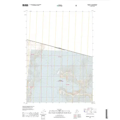
2018 Map of Sumdum A-1 SW
USGS Topo · Published 2018About this map
LeConte Glacier dominates the upper reaches of this international boundary zone where Alaska meets British Columbia. Situated within the protected expanse of the Tongass National Forest, the landscape is defined by high-altitude glacial ice and steep contour lines that illustrate the dramatic elevation shifts of the Coast Mountains. The map clearly delineates the United States-Canada border, providing a precise look at how the geopolitical line bisects these icefields. Because this is a high-latitude wilderness area, the map is remarkably sparse of human infrastructure, focusing instead on the physical geography and the natural movement of ice through the rugged terrain. Researchers and glaciologists can use this survey to examine the footprint of the glacier and its surrounding peaks as they stood in the early twenty-first century.
Find a feature on this map
7 named features on this map. Tap any name to fly to it.
Don’t see what you’re looking for? This feature index may not catch every label — zoom into the map to look around manually.
Map Details
Editions of this 2018 Sumdum A-1 SW Map
This is the sole edition of this map. No revisions or reprints were ever made.
Other maps of this area

1952 · Petersburg
USGS Topo · 1:250,000

1952 · Sumdum
USGS Topo · 1:250,000

1960 · Petersburg
USGS Topo · 1:250,000

1960 · Sumdum A-1
USGS Topo · 1:63,360

1961 · Sumdum A-2
USGS Topo · 1:63,360

1961 · Petersburg D-1
USGS Topo · 1:63,360

1961 · Petersburg D-2
USGS Topo · 1:63,360

1961 · Sumdum
USGS Topo · 1:250,000

1994 · Petersburg D-2
USGS Topo · 1:63,360
2000 · Petersburg D-1
USGS Topo · 1:63,360