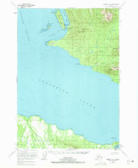
1948 Map of Sumdum A-5
USGS Topo · Published 1972About this map
Frederick Sound and Stephens Passage converge in this mid-century maritime survey, documenting a rugged stretch of the Alexander Archipelago. The landscape is dominated by the Fanshaw Range and prominent peaks like Mount Fanshaw and Dahlgren Peak, which rise sharply from the coastline. Evidence of early industry and habitation appears at Cape Panshaw, where a Cannery (Aband) and a Light are situated near Whitney Island. To the south, the northern shoreline of Kupreanof Island is mapped, featuring the Bohemian Range and the sheltered waters of Portage Bay. The presence of scattered Cabins and navigational markers like Bird Rk highlights the era's reliance on coastal waterways for transport and commerce before the establishment of modern infrastructure in this remote coastal region.
Find a feature on this map
32 named features on this map. Tap any name to fly to it.
Don’t see what you’re looking for? This feature index may not catch every label — zoom into the map to look around manually.
Map Details
Editions of this 1948 Sumdum A-5 Map
3 editions found
Other maps of this area

1943 · Sumdum B-4
USGS Topo · 1:63,360

1948 · Sumdum A-4
USGS Topo · 1:63,360

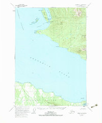
1948 · Sumdum A-5
USGS Topo · 1:63,360

1948 · Sumdum A-6
USGS Topo · 1:63,360

1948 · Sumdum B-6
USGS Topo · 1:63,360

1948 · Sumdum B-5
USGS Topo · 1:63,360

1948 · Sumdum B-4
USGS Topo · 1:63,360

1948 · Petersburg D-6
USGS Topo · 1:63,360

1948 · Petersburg D-5
USGS Topo · 1:63,360

1951 · Petersburg D-4
USGS Topo · 1:63,360