
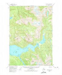
1948 Map of Sumdum B-4
USGS Topo · Published 1958About this map
Glacial carvings and deep fjords define this portion of the Tongass National Forest along the mainland coast. The prominent Port Houghton serves as the primary waterway, branching into the Walter Island Arm and leading toward a significant Tidal Flat. High-altitude surveying points like VABM 5188 Triple C and Washington Peak mark the steep elevations that rise abruptly from the sea.
Find a feature on this map
14 named features on this map. Tap any name to fly to it.
Don’t see what you’re looking for? This feature index may not catch every label — zoom into the map to look around manually.
Map Details
Editions of this 1948 Sumdum B-4 Map
2 editions found
Other maps of this area

1943 · Sumdum B-4
USGS Topo · 1:63,360

1948 · Sumdum A-4
USGS Topo · 1:63,360

1948 · Sumdum A-5
USGS Topo · 1:63,360

1948 · Sumdum C-5
USGS Topo · 1:63,360

1948 · Sumdum B-5
USGS Topo · 1:63,360

1951 · Sumdum C-5
USGS Topo · 1:63,360

1951 · Sumdum A-4
USGS Topo · 1:63,360

1951 · Sumdum B-5
USGS Topo · 1:63,360

1952 · Sumdum
USGS Topo · 1:250,000

1961 · Sumdum C-3
USGS Topo · 1:63,360